Difficulty
-
Strenuousness:3 (Full day)/5
-
Navigation:2/5
-
Technicality:3/5
Info
-
Terrain:Rough rocky ground, grassy slopes, bog and occasional exposure
-
Time:5.5 hours
-
Distance:14km / 9 miles
-
Total Ascent:1000m
-
Starting Point:Seathwaite
-
Nearest Town:Rosthwaite
-
Public Transport:78 Bus Keswick - Seatoller (no closer public transport links)
Maps
Correct as of 2026-06-25 at 09:34 / Images from Amazon Product Advertising API. We might receive a small commission for any purchases through links on this page, with no extra cost to you.
The route from Borrowdale is a long, but less steep, ascent of Scafell Pike. It is a full day’s walk, climbing up into the mountains alongside a river, then joining with the Langdale route at Esk Hause.
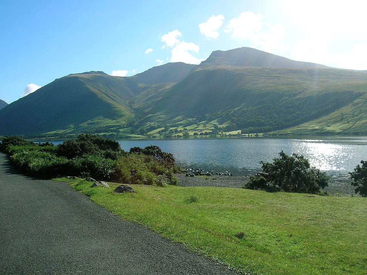
Drive to the head of the Borrowdale valley and take the small left turn to Seathwaite, and park on the roadside (free of charge) at the end of the lane near Seathwaite Farm (OS ref: NY235122). This is usually very busy in summer and the farmer often opens up a field for extra paid parking.
Reaching Scafell Pike from Borrowdale is one of the most popular routes up Scafell Pike, you’ll see why as you continue. Set off along the track southwards through the lovely old farmyard and out into the open valley. Follow the track alongside the river to the delightful Stockley Bridge (OS ref: NY235109)
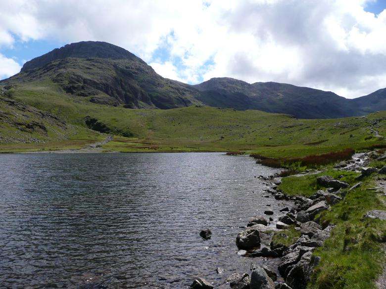
Cross the bridge and go through the gate, taking the path to the left which continues to follow the river up Grains Gill. The path is well maintained; rising gradually at first, then more steeply alongside the tumbling waterfalls of Grains Gill until it meets a larger track running east-west (OS ref: NY229087, on this map) beneath the towering cliffs of Great End directly in front of you.
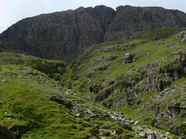
Turn left (east) here and after 500m take the path which rises to the right up towards Esk Hause (OS ref: N233081, on this map), where the stunning view south into Eskdale awaits. From Esk Hause, take the path westwards, climbing between Great End and Ill Crag, and across the boulder-strewn slopes of Broad Crag from where the towering summit of Scafell Pike finally comes into view.
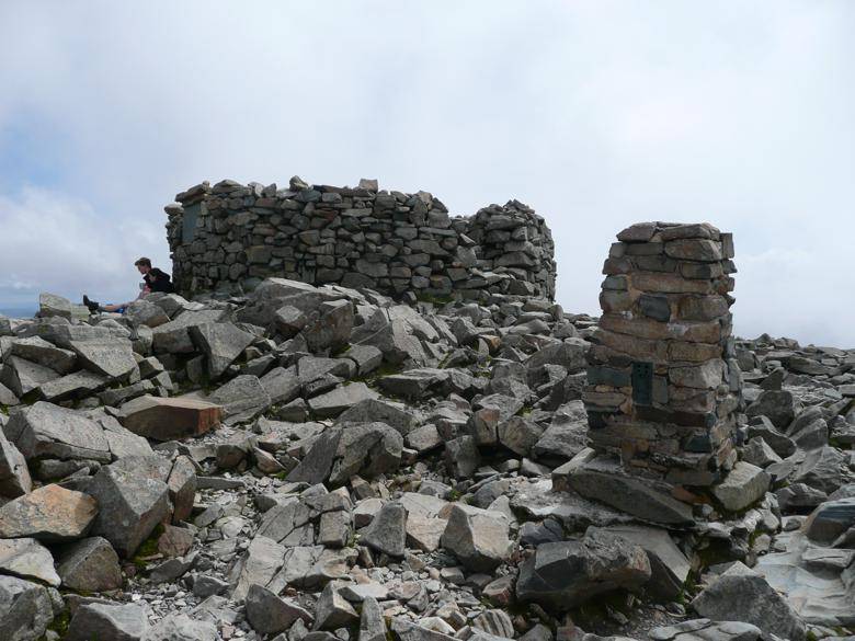
Progress across the boulders here requires care and a tinge of disappointment awaits as you see the hard-earned height which must now be lost before the final ascent to the summit can begin!The final climb is steep and the ground is loose, but the summit plateau is soon reached and the giant cairn (OS ref: NY215073, on this map) which marks the highest point in England comes back into view. Time for a well-earned break to enjoy the sense of achievement and take in the breath-taking panoramic views!
But time waits for no man, and one of the most beautiful paths imaginable still awaits. From the summit, head north-west towards Lingmell. The path is a mass of boulders but well-marked with cairns and drops quickly down to Lingmell Col where it meets the path rising up from Wasdale to the south-west. Here, take the path to the right (north-east) which is the beginning of the delightful “Corridor Route”.
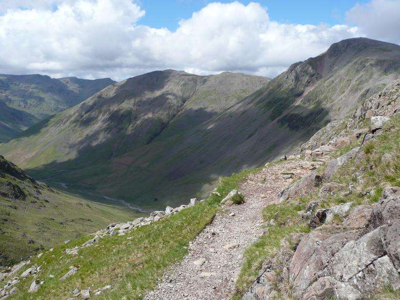
Contouring and dropping in stages, the path has towering peaks and crags to the right and dizzying views down into Wasdale to the left, until a short final climb leads up to Sty Head Pass (OS ref: NY219095, on this map).
Spend a few minutes sitting by Styhead Tarn looking back up towards Scafell Pike, as this will be your last view of the peak, before descending along the path to Styhead Gill until it reaches Stockley Bridge and the easy final stroll back to Seathwaite.
Borrowdale Weather Forecast
The data for the weather forecast for Borrowdale has been provided by the Met Office. The data is updated once daily, so please ensure you check the Met Office website for the most recent information. The exact location of the data refers to the Borrowdale Youth Hostel (lat: 54.5186, long: -3.1494).
Data provided by the Met Office. When considering Scafell Pike weather, take note that the conditions you encounter at the base of Scafell Pike may be vastly different from those you experience at its summit. Higher altitudes often bring colder temperatures, stronger winds, and decreased visibility. Therefore, it is always advisable to check the mountain weather forecast before you set off for your hike.
Frequently asked questions about Scafell Pike from Borrowdale
What can I expect from the Scafell Pike route from Borrowdale in terms of difficulty and duration?
The Scafell Pike route from Borrowdale is a full day’s walk, rated as 3 out of 5 in terms of strenuousness and technicality. The route spans a distance of 14km or 9 miles, with a total ascent of 1000m. It typically takes about 5.5 hours to complete the hike. The terrain is varied: rough rocky ground, grassy slopes, and occasional boggy areas.
Where does the Borrowdale route to Scafell Pike start and how can I get there?
The route starts from Seathwaite. You can drive to the head of the Borrowdale valley and park your car on the roadside near Seathwaite Farm. Please note that this area can get very busy in the summer, but the farmer often opens a field for extra paid parking. The 78 Bus from Keswick to Seatoller is the closest link if you’re using public transport.
Could you walk me through the main points of the Borrowdale route to Scafell Pike?
The route from Borrowdale is a less steep yet long ascent of Scafell Pike. You’ll start by following a track alongside a river, up through Grains Gill, beneath the towering cliffs of Great End. From there, you’ll head east towards Esk Hause, offering a stunning view south into Eskdale. The path then continues westwards, climbing between Great End and Ill Crag and across the slopes of Broad Crag, eventually leading to the summit of Scafell Pike.