Difficulty
-
Strenuousness:2 (Short day)/5
-
Navigation:3/5
-
Technicality:4/5
Info
-
Terrain:Steep pitched paths, rough rock, unbridged Lingmell Gill crossing and exposed summit plateau
-
Time:4.5 hours
-
Distance:9km / 6 miles
-
Total Ascent:900m
-
Starting Point:Wasdale Head Green car park (NY187085)
-
Nearest Town:Wasdale
-
Public Transport:Seasonal Wasdale Explorer: check the current National Park timetable. No year-round service assumed.
Maps

A direct but steep mountain route from Wasdale Head Green via Brown Tongue and Hollow Stones. Rough ground, an unbridged beck crossing and summit navigation require preparation and map-and-compass skills.
Compare the five Scafell Pike walks before choosing this route.
This guide follows the Wasdale Head approach to Scafell Pike via Brown Tongue and Hollow Stones, returning by the same route. It does not start at the National Trust Lake Head car park.
This is a steep mountain walk over rough stone and an exposed summit plateau. Being short does not make it an easy beginner walk. You need fitness, suitable equipment and someone able to navigate in poor visibility. If that is beyond your experience, choose a lower walk or a qualified mountain leader. Read the preparation guide and check mountain weather.
From Wasdale Head to Brown Tongue
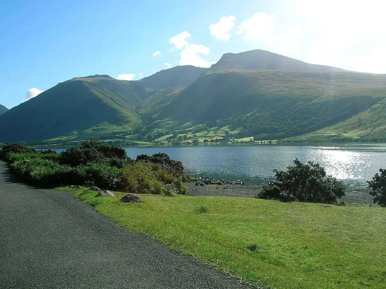
Start at Wasdale Head Green car park (NY187085). Take the public footpath southeast across the valley to the footbridge over Lingmell Beck (about NY189082). This bridge is separate from the higher, unbridged Lingmell Gill crossing.
Beyond the bridge, follow the hillside path south across the lower shoulder of Lingmell. Stay on the connecting path towards Lingmell Gill rather than turning uphill for Lingmell’s summit. It joins the main Lake Head ascent near NY192074. Note this junction for your return to Wasdale Head.
Continue upstream on the main ascent. Cross Lingmell Gill only if safe; heavy rain can make the return crossing impassable even if you crossed on the way up. Turn back before an unsafe crossing. Climb Brown Tongue to the path split at approximately NY201072. Take the Hollow Stones branch, not the Mickledore branch.
Hollow Stones and the summit
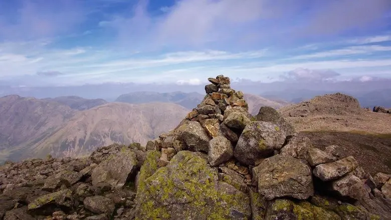
The Hollow Stones path bends northeast through rocky ground and zigzags uphill to the junction above Lingmell Col (about NY210076). Identify this junction for the descent. Take the ascent towards Scafell Pike, initially south then bending east towards the summit (NY215073). The summit plateau is rocky and hard to navigate in cloud. Extra cairns may be misleading.
Return to Wasdale Head
Locate your ascent route with your map and compass before leaving the summit. Return along it to the junction above Lingmell Col. Take the Hollow Stones path back down; do not continue towards the Corridor Route or descend into Piers Gill. Wasdale Mountain Rescue warns of serious and fatal accidents around Piers Gill. Following a stream downhill is not a safe shortcut.
Descend through Hollow Stones and Brown Tongue, reassess the Lingmell Gill crossing, then retrace the lower hillside connection to the Lingmell Beck footbridge and Wasdale Head Green. Continuing down the main Lake Head path would take you to the other car park. The Wasdale Head Inn (about NY186088) is beyond the Green, not the finish of the mountain path.
Parking and access: two different starts
This guide starts at Wasdale Head Green car park, NY187085, further up the valley than Lake Head. Check signs and local parking arrangements on arrival; the National Trust tariff below does not describe this car park. Bring drinking water rather than relying on a refill point.
Lake Head National Trust car park, NY182075, is beside the National Trust Wasdale campsite. It has toilets and a welcome centre. The Trust’s Hollow Stones guide starts here (NY183075 in its start description), so its approach and distance differ from this guide.
The National Trust parking page, checked 30 September 2026, lists Lake Head at £7 for up to two hours, £8.50 for up to four hours and £10 all day. Charges apply at all times. Members scan their membership card for free parking. Carry change: mobile reception is limited and card/phone payment is not available everywhere. The Trust advertises JustPark at many car parks; set it up beforehand and check the signs at your chosen car park. Do not assume coin-only payment or guaranteed card payment. Check current charges before travelling. Overnight parking is not permitted in the Trust’s car parks.
Seasonal transport
The National Park’s dated 2026 Wasdale Explorer information, checked 30 September 2026, lists weekends and bank holidays from 2 May to 31 August, £3 for all-day travel and children free. That season has ended. It served Ravenglass, Gosforth, Nether Wasdale, the National Trust campsite road end and Wasdale Head Green. Check the current season, timetable and last return journey before making plans; do not assume a year-round bus. The National Trust page still gives different, undated shuttle details, so use the dated National Park information.
Use our getting-there guide to plan the complete outward and return journey.
Camping near the start
The National Trust Wasdale campsite is beside Lake Head, not Wasdale Head Green. Check the campsite’s booking and facilities information directly. See campsites near Scafell Pike and other accommodation for alternatives.
Where to Stay: The Wasdale Head Inn
The Wasdale Head Inn is an ideal base for your Scafell Pike adventure. This historic inn in the valley heart is known for its warm hospitality and rich climbing heritage.
Wasdale Weather Forecast
This is a valley forecast, not a forecast for the summit. Check the forecast update time and the mountain weather forecast before setting out; conditions higher up can be much colder, windier and less visible.
Forecast for Wasdale Head (83 m above sea level).
Source: Met Office.
Forecast updated (model run): .
Times are UK local time. Temperature ranges, maximum gusts and rain chances cover the three hours ending at each time shown.
Today 18 October 2026
Tomorrow 19 October 2026
Tuesday 20 October 2026
Wednesday 21 October 2026
Thursday 22 October 2026
Conditions in the valleys can differ greatly from those on the summits. Read the Met Office Lake District mountain forecast and MWIS Lake District forecast for hazards, cloud and visibility before setting off.
Sources and route review
Research checked 30 September 2026. This is a planning guide, not a field survey or a substitute for a current map and compass. No recent walk or qualified mountain-guide review is claimed. Plan the return before setting out.
- National Trust: Hollow Stones route and OS route map (Lake Head approach).
- Wasdale Mountain Rescue: Piers Gill hazards.
- Wasdale Mountain Rescue: preparation and navigation.
Use current OS Explorer OL6 mapping to identify your start and route. Grid references here are approximate landmarks, not instructions to walk straight between points. Path condition, crossings, signs and the Wasdale Head connecting paths need competent local review. A photograph can help memory but cannot replace navigation.
Frequently asked questions about Scafell Pike from Wasdale Head
How demanding is the climb to Scafell Pike via the Wasdale Head route?
A steep mountain walk requiring fitness and navigation skills, especially in cloud. The guide estimates 4.5 hours for the round trip, plus breaks and extra time for conditions. This is not a deadline or a guarantee. A short route can still be demanding; do not rely on following other walkers or cairns.
Where does the journey on the Wasdale Head route commence?
Wasdale Head Green car park (NY187085). The route crosses Lingmell Beck by footbridge near NY189082, then joins the main ascent. Lake Head National Trust car park (NY182075) is a different start beside the campsite; its charges and facilities must not be confused with Wasdale Head Green.